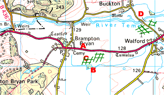
Map of area shown in aerial photographs. A & B show some woods marked on the photographs, two trees are at C and a bridge at D. Approximate location of camps shown by green hatching. Click photographs below to enlarge.
Map of area shown in aerial photographs. A & B show some woods marked on the photographs, two trees are at C and a bridge at D. Approximate location of camps shown by green hatching. Click photographs below to enlarge.